✈
AutoFRAT Beta
Flight Risk Assessment for General Aviation Pilots
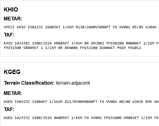
Real-Time Weather
Near real-time METARs, TAFs, AIRMETs, and SIGMETs from official aviation weather sources for your entire route.
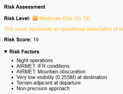
Risk Scoring
Produces a risk analysis using a structured rubric driven by environmental hazards, with optional pilot and aircraft modifiers.
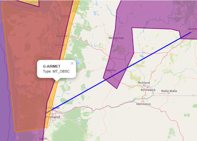
Interactive Map
Visualizes your flight route with weather hazard polygons, helping you see where conditions may impact your flight.
Enter Beta Access
Enter your transponder code to access the tool
Don't have a code? Sign up for beta access